HYANNIS – Is traffic on Barnstable’s mean streets driving you mad? Do you long for the old days when a person could get from Cotuit to Hyannis without spending what seems like a week behind the wheel?
Not so fast. Those old days may not have been so traffic-free as one would imagine and the streets may have been just as mean.
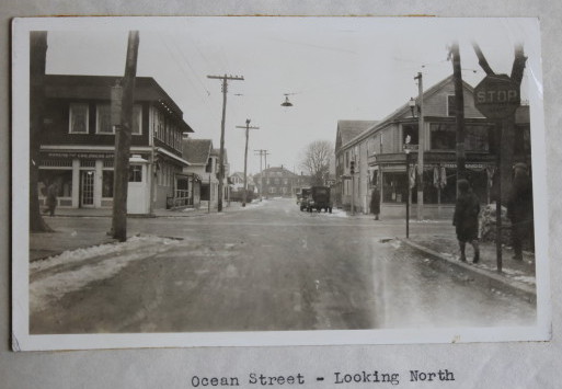
Ocean Street looking north in 1930.
A recently discovered antique document is a time travel machine to the days of the when Model T’s were tearing up the roads from Osterville to West Barnstable.
On February 12, 1930, the Automatic Signal Company of New Haven, Connecticut
presented William Lovell, then-chairman of the Board of Selectmen of the Town of Barnstable, with a traffic survey.
The company was trying to sell the town on a new kind of “smart” traffic light.
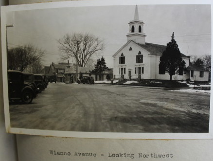
Wianno Avenue, looking northwest, Osterville, 1930.
It seems the town did not go for the contraptions, called “Electro-matic Vehicle Actuated Traffic Dispatching Systems.”
But the report produced by the company, a slim cardboard-bound notebook with a dark green cover and filled with blueprints and black and white photos, is a window into its roadway dilemmas of 83 years ago.
Several of the intersections surveyed by the Connecticut company are still major problems today.

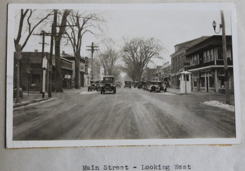
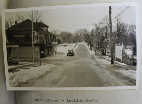
Main Street, Osterville, looking east, 1930.
The intersection of Main and Ocean streets and Barnstable Road in Hyannis is one prime example.
The report states bluntly, “The visibility is poor at all the corners.”
Back then, the intersection was such a problem that a booth was constructed on the northwest corner where a police officer stood all day, manually controlling the traffic signals.
Eugene Burman, 83, remembers that corner well and the “tower” where the officer stood.
As a child growing up in Hyannis, he walked from his home, behind where Alberto’s restaurant is now, to his elementary school, a block down Ocean Street to a red brick building that is now a Verizon telephone office.
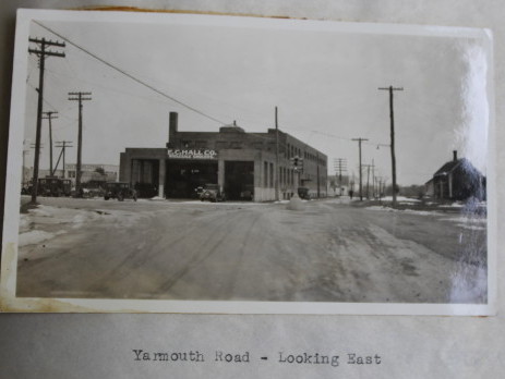
Yarmouth Road looking north in 1930.
Back in the 1930s, the intersection had Myers Furniture Store on one corner, a lady’s clothing store called Perlstine’s on another, the First National Bank, and Olympia restaurant on the other two corners, Burman said.
“There was lots of traffic and you had to be very careful,” he recalled.
Mark S. Ells, Barnstable Assistant Town Manager and former Director of Barnstable’s Department of Public Works, said that even today, during the busiest times in the summer, a police officer is stationed at the Ocean Street intersection.

Iyanough Road (Route 28) looking east, 1930.
He said, traffic at the intersection is exasperated by emergency vehicles heading to the hospital and ferry traffic headed down Ocean Street to the harbor.
“There’s a tremendous amount of traffic and a lot of pedestrians,” Ells said.
But, as Burman put it, “’busy’ when it comes to traffic, is a relative term.”
Burman estimates that back in the 1930s there was about 10 percent the traffic there is now in town.
Burman’s father and grandfather ran a men’s clothing store on Main Street called Burman’s, which was started in 1922. Burman later took it over and ran it until 1976, when he closed it because he was also running the Charles Motor Lodge a few blocks west on Main Street. That hotel is now the International Inn.
Main Street, Cotuit, looking north, 1930.
Hyannis’s Main Street was two-way back then and the report states that “the speed of traffic through the Ocean Street intersection . . . becomes very low during periods of extremely heavy traffic.”
But by the end of summer, as Burman remembers it, everything changed.
“Come Labor Day, you could do bowling on Main Street,” he said. “Everybody was gone.”
That seasonal adjustment in traffic flow is one aspect that has definitely changed, Burman said.
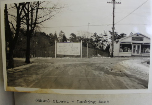
School Street, Cotuit, looking east, 1930.
Nowadays, “it doesn’t really stop. It goes right through. It starts January 1 and goes to December 31,” he said.
Another problem intersection cited in the 1930 report was Iyanough Road (Route 28) and Yarmouth Road.
That intersection is also well-known by Burman who chaired the Barnstable Traffic and Transportation Committee in the 1970s. He also spent 32 years on Barnstable’s Zoning Board of Appeals and is now a member of the Barnstable Licensing Authority. and
In the 1970s, the traffic was about 25 percent of what it is now, Burman guessed.
The committee produced a report that recommended various changes to roadways as a way to deal with traffic problems.

Route 130 at Route 28, looking south.
The committee focused on the Yarmouth Road intersection.
“There was a lot of planning, most of which got filed in the archives,” he said.
“Because traffic was a problem even then,” Burman said.
As for the Yarmouth Road intersection? “To this day, they have not fixed it,” Burman said.
Ells said that from a heavy traffic standpoint, Yarmouth Road at Route 28 is “the major intersection in town.”
Route 130 at Route 28, looking south.
The intersection is now part of the planning for the Hyannis Access Study and ideas including a tunnel and a bridge have been floated as to how to keep the traffic moving in the area.
“That’s really the slow cog in the wheel,” Ells said. “That’s a major intersection and it’s going to need an upgrade.”
Other intersections covered in the report area also still problem areas today. One is the intersection of Route 132 and Route 6A, or, as the report puts it, “Iyanough Road and King’s Highway.”
The problem back in 1930 was “the speed of traffic is fairly high on all three approaches.”
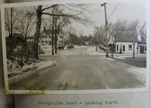
Craigville Beach Road looking north,1930
The problem today, according to Ells, is the amount of traffic and the “big wide open intersection.” He said the state is considering a rotary for the intersection, which state highway officials have scheduled for 2016.
“It has been identified to be modified,” Ells said.
Also covered in the 1930 report are the intersections of Mill Way and Route 6A in Barnstable Village and the intersection of South Main Street and Craigville Beach Road in Centerville.

South Main Street looking east, 1930.
Ells said both intersections can be very busy, particularly in the summer when harbor and beach traffic, respectively are at full throttle.
The Centerville intersection, which is a few dozen feet from Ells’s house, backs up on sunny beach days in the summer, he said.
But Ells said he does not really mind the traffic just outside his door.
“It’s summer. The fact that all the people are here. It’s exciting,” he said.
Burman, who is now a real estate broker with Carey Commercial Real Estate, declined to answer a question on how traffic impacts the quality of life in the Town of Barnstable today.
“I’d prefer not to comment,” he said.
– Laura M. Reckford